GIS analysis and mapping sit at the heart of how we approach spatial planning and understand the way projects fit within their physical and planning context. Mansergh Graham uses a full Geographic Information System (GIS) to manage, analyse and present large volumes of spatial information, supporting evidence-based decisions about where and how development should occur. By combining multiple data layers – such as topography, land use, zoning and overlays, visibility, infrastructure and ecological values – we identify constraints and opportunities, and clearly show how different land uses and patterns of development interact across a site or wider area. GIS underpins much of our landscape, natural character and visual assessment work, and we also provide stand-alone GIS services to support other consultants, including ecologists, engineers and resource management planners.


Our GIS analysis and mapping services include:
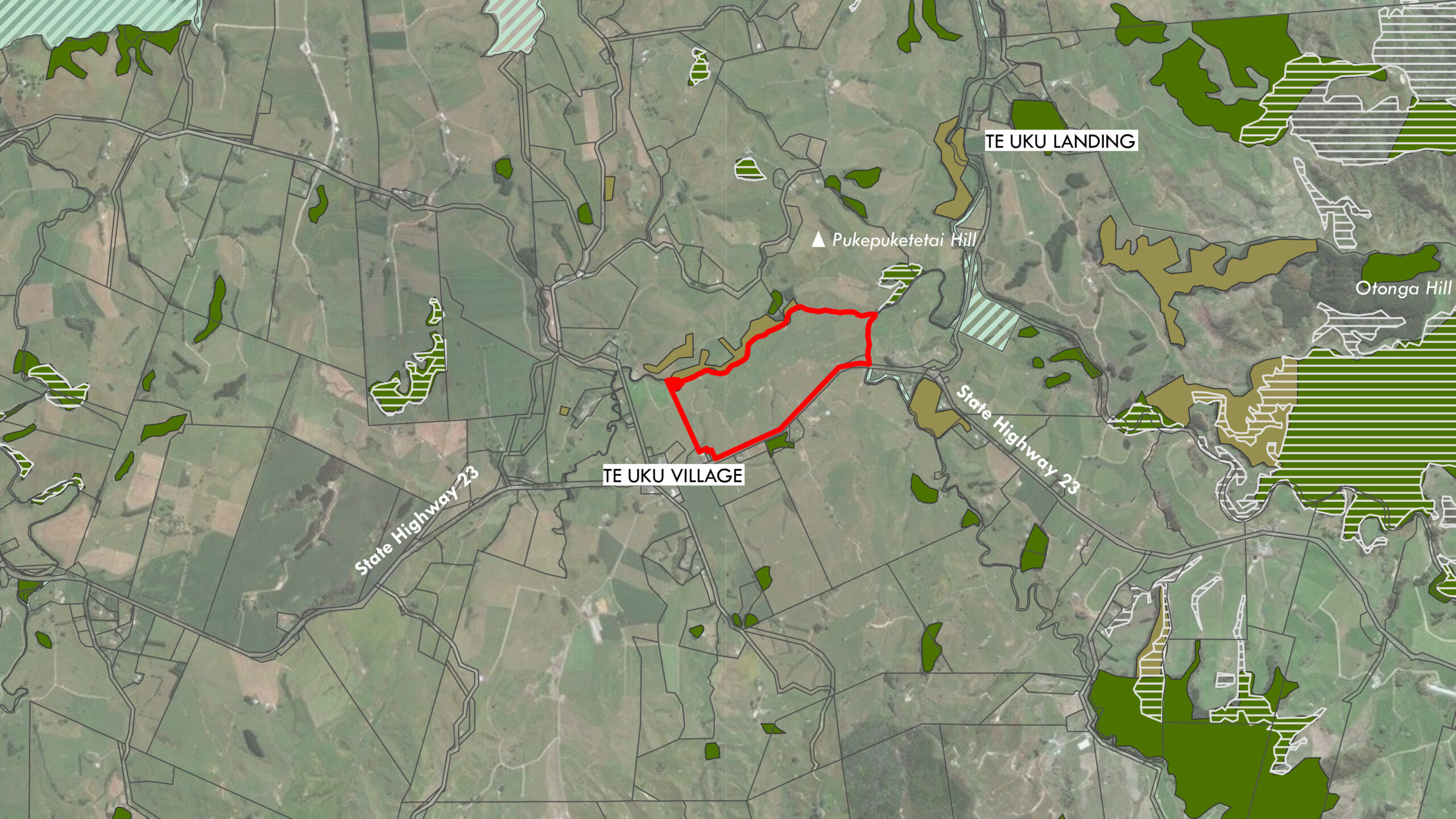
- Topographic and feature mapping, producing clear base plans, constraints plans and thematic maps for reporting and design.
- Slope, aspect and shade analysis, helping to identify suitable development areas, planting zones and potential constraints.
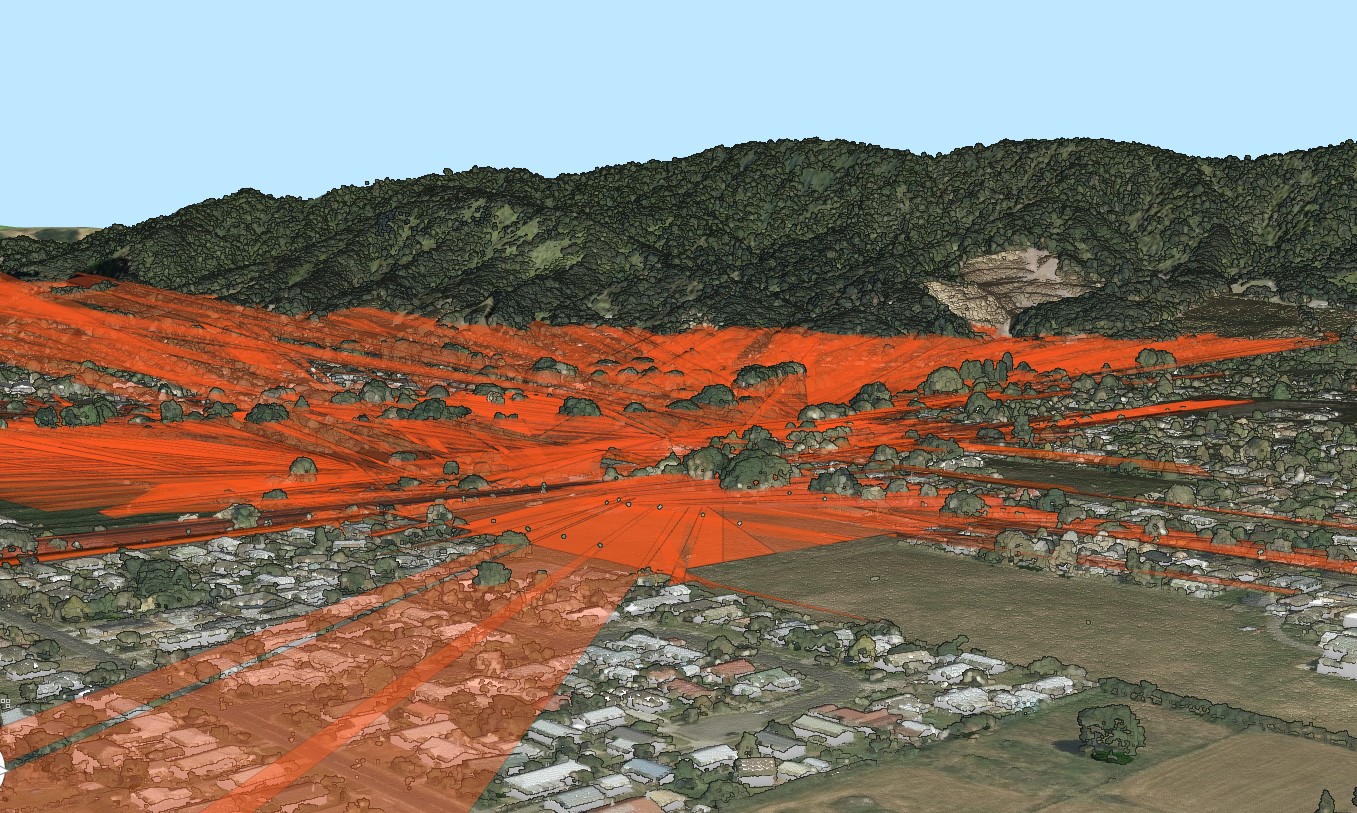
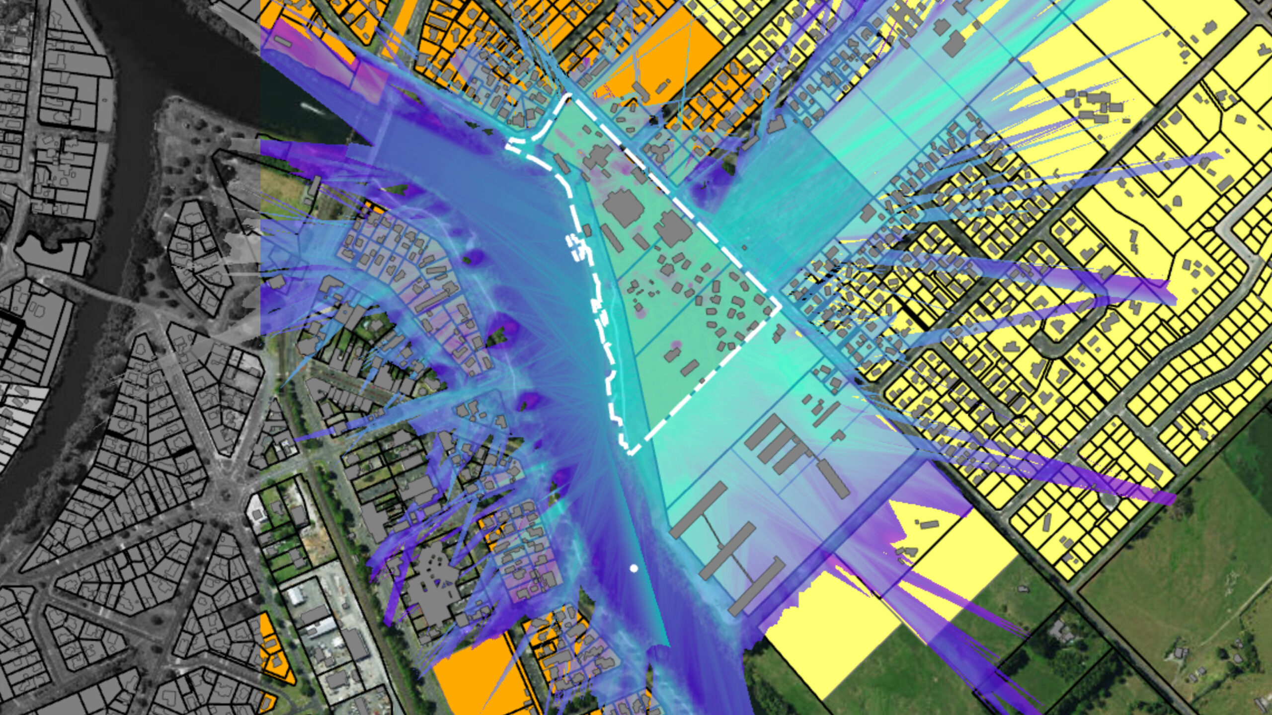
- Viewshed analysis, modelling visibility from key viewpoints to understand and illustrate potential visual effects.
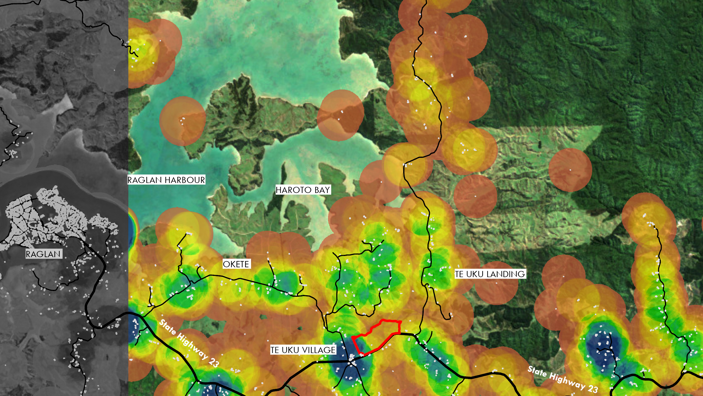
- Sieve mapping, overlaying multiple constraints and opportunities to support robust site selection and design decisions.
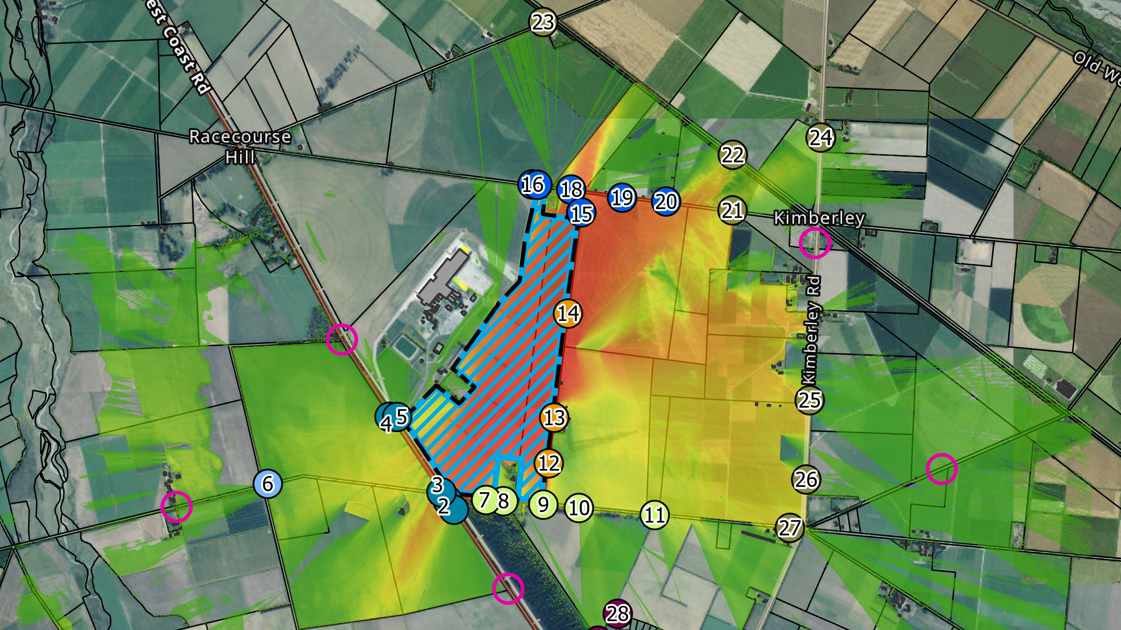
- Weighted site selection and analysis, using multi-criteria analysis to identify preferred sites, alignments and options.
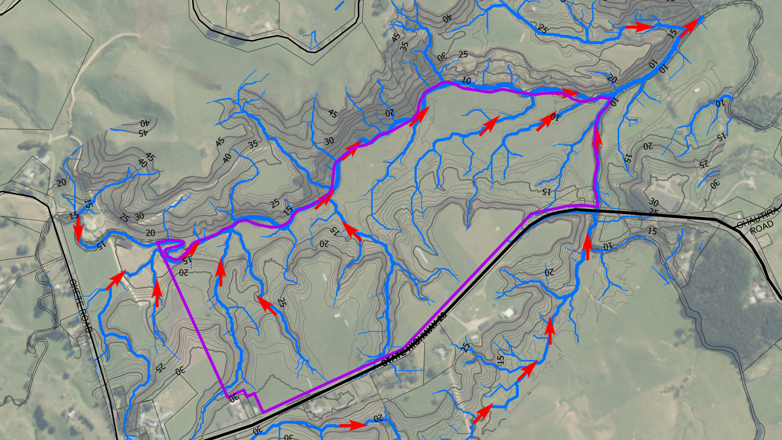
- Catchment mapping and analysis, defining drainage patterns and contributing areas for hydrological, ecological and planning purposes.
- Route and corridor analysis, to identify optimal locations for roads and infrastructure.
- Land use analysis for spatial and land use planning purposes, including development density studies, height and shading analysis, visibility analysis, solar gain analysis, topographic analysis.
- Geo-spatial database management, organising and maintaining project spatial data for consistent use across teams and disciplines.