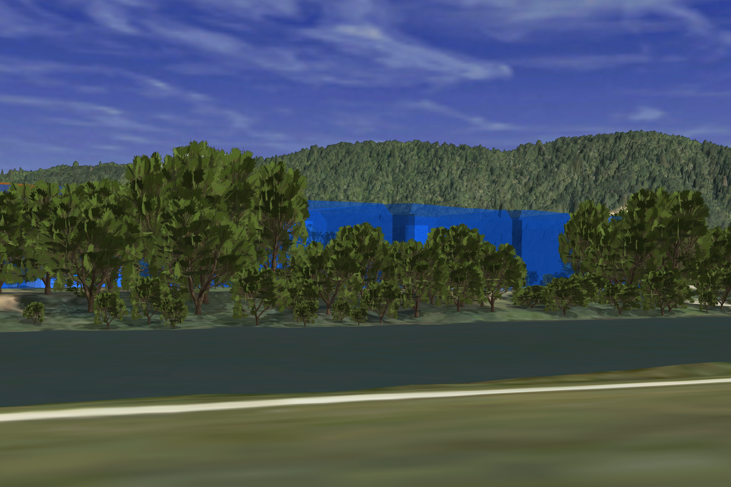
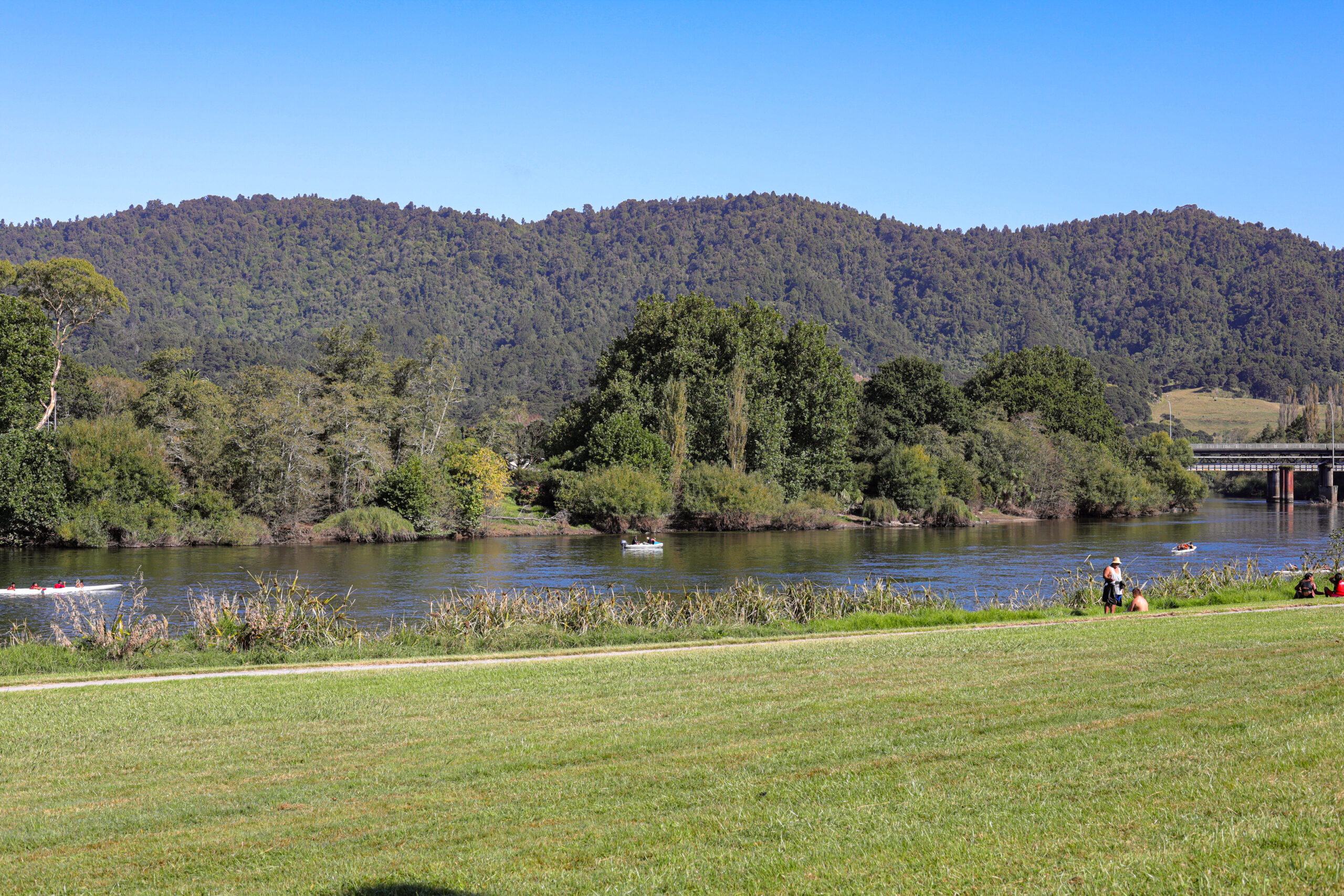
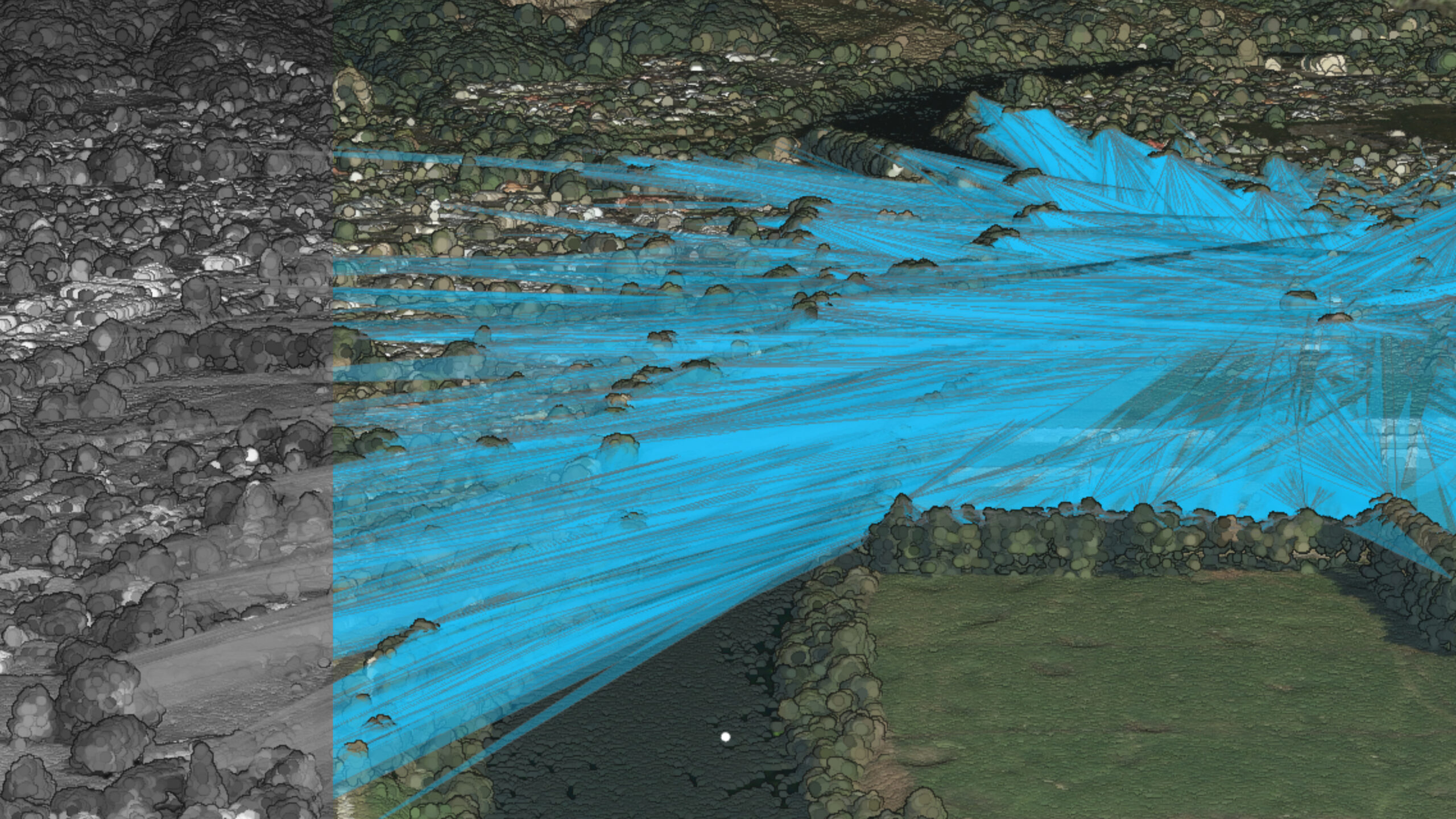
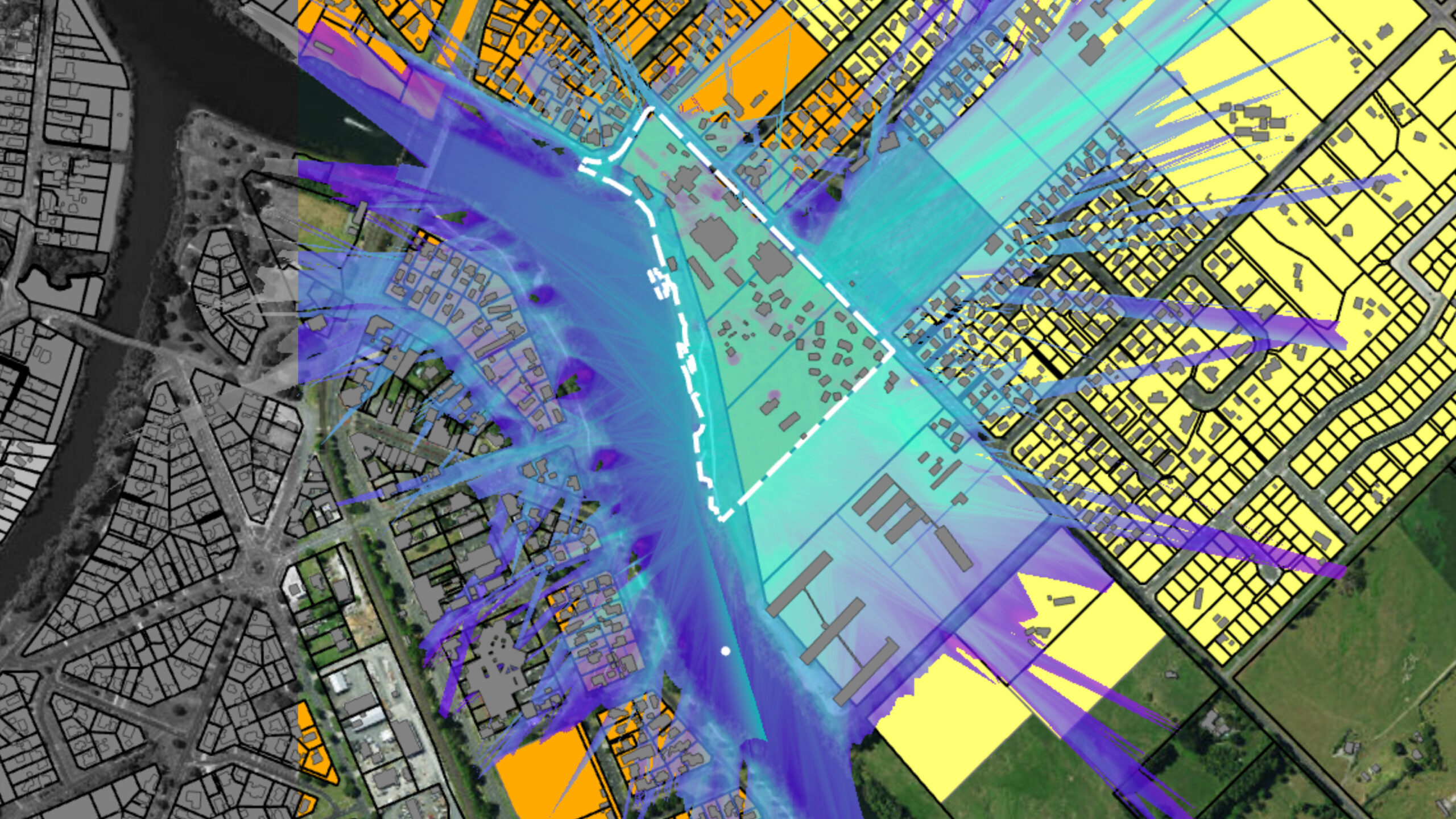
The introduction of Variation 3, driven by the Enabling Housing Act, sparked concerns from the Tūrangawaewae Marae and other stakeholders about the potential impact of urban intensification on culturally significant landscapes such as the Hakarimata Range, Taupiri Maunga, and the Waikato Awa. In response, a collaborative effort between the Marae, Council, and Kāinga Ora was undertaken, utilizing advanced GIS and 3D modelling to assess the visual and cultural effects of various development scenarios. This approach allowed all parties to better understand the implications of the proposed changes, leading to informed decision-making and the successful resolution of concerns.
Our Role:
- GIS analysis and development scenario modelling.
- Consultation with the representatives of Tūrangawaewae Marae.
- Identification of the affected cultural landscape and viewshafts.
- Presentation of landscape evidence at the plan change hearing.
- Preparation of maps and overlays for inclusion in the district plan.